Welcome to BRBRbrooklyn! Whether you are pedaling to the shore, the store, your neighbor’s stoop, or back to your own coop, this blog is for you. Bay Ridge Bicycle Routes is an effort raise to awareness within our neighborhood and among civic groups about the activities of bicyclists in Bay Ridge and other nearby communities in southern Brooklyn.

Our neighborhood’s immediate access to the harbor, less congested street traffic, friendly atmosphere, expansive parks and flat terrain (except, of course, for the steep ridge in Bay Ridge!) makes our corner of New York City one of the most fantastic places to ride a bicycle. Whether for transportation, recreation, fun or fitness, cycling is great in Bay Ridge.

Monday, December 27, 2010

NYC DOT Bike Share Request for Proposals


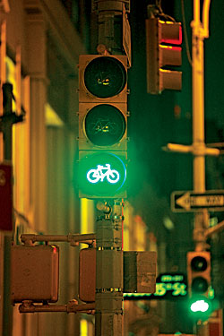
DOT has issued a request for proposals for private companies to provide a bike share system in New York City. Bike share will serve as a new public transportation system complete with durable bicycles and docking stations to provide convenient and inexpensive mobility twenty-four hours a day, 365 days a year. Bike share is envisioned to be used primarily for trips under 3 miles. DOT anticipates the system would start in spring of 2012.

The responses are due in February 2011. A test of the system will occur in late 2011 and a projected start for the full network in April 2012.

Preliminary analyses, conducted by NYCDOT and New York City Department of City Planning, indicate that a financially self-sustaining System would cover the CBD (south of 60th Street in Manhattan) and surrounding neighborhoods. NYCDOT estimates that a System of this size would require approximately 10,000 bicycles spread over approximately 600 stations. NYCDOT is particularly interested in Systems that span more than one borough and make the best use of the City’s burgeoning bicycle network.

Read more here.

Sunday, December 19, 2010

New Street Organization in "Shakedown Street"

The Op-Art Piece posted in today's New York Times by Bruce McCall.

Yeah, admit it, this is quite funny and brilliant. Look closely at the illustration - it is the complete inversion of street and sidewalk functions with cars on the sidewalks and people in the streets. Though if it was me, I'd have organized the street lanes as:

A: skateboard/scooter/segway
B: stroller
(A and B together allows kids to skate next to their parents and infant baby brothers and sisters)

C: Traffic Agent
(close to the DMZ and quick enforcement of unoccupied strollers)

D: prohibited lane (D.M.Z.)
(to separate strollers from the speediest, see below)

E: bicycle
F: equestrian
G: jogger
(E and G on either side of F allows for some great commuter races, as noted in this prior post by the NYTimes, "Let's Race".)


Owl's Head Park Greenway Open!

It is confirmed - the NYC Greenway connector at Owl's Head Park in Brooklyn is now open for use!


During a cold evening ride a few days ago, we spotted the newly paved asphalt hiding behind the construction fences along the northern edge of Owl's Head Park. When we returned yesterday, the fencing to the path was removed and open for use. The walking/biking/skating path extends from the corner of Shore Road and 68th Street to Colonial Road and Wakeman Place along the northern edge of the park. This route gives access to Millennium Skate Park near Wakeman Place and the newly renovated dog run near 68th Street.

From our checks on Google and a roll-off from a bicycle computer, we calculated the length of the Greenway at about 2000' (.37 miles) and a slightly curving 325' length of dog run.

While chatting with a dog and his owner, we learned that the dog run and Greenway had just opened on Monday. We saw several dogs and their walkers along the Greenway and a few fishermen going to and from the 69th Street Pier along the Greenway. This Greenway also provides a continued route north for all the cyclists who reach the end of Shore Road and used to ride opposite the traffic direction on 68th Street to return into the neighborhood, solving a problem we saw in our Shore Road Bike Lane post.


Map It


Greenway entrance at Shore Road and 68th Street


Near 68th Street and pathway leading into the park. Construction fence still to be removed.


Going to the dog run.


Looking north from near 68th Street: the dog run is ahead on the left, signage and markings for the entrance, and the slope of Owl's Head Park on the right.


Greenway entry at Colonial Road and Wakeman Place


Millennium Skate Park near Wakeman Place and Colonial Road.


View from the Greenway to Colonial Road and Wakeman Place.

Wednesday, December 15, 2010

Reasons to Love NY #21


The 2010 edition of New York Magazine's "Reasons to Love New York" gives a bit of history on the toehold bicycle lanes first made into NYC in 1980 at Herald Square and how the bicycle traffic light "causes barely a ripple in the city’s traffic flow, but the lights have finally tamed our intersections." Read more.

Sunday, December 12, 2010

Owls Head Park Bike Lane

Breaking News: We've seen the paving for the new Owls Head Bicycle lane.

It still resides behind the chain-link fence but it is certainly a new bicycle lane - a Class I Lane, physically separated from traffic completely.

It is a two-way asphalt lane extending from the corner of 68th Street and Shore Road northward through the park, along the edge of the access road to the Belt Parkway.

With the recent cold, rain, and early sunsets of the past few weeks, we had not taken a ride by the area in daylight in about a month. We'd guess the lane paving was done sometime in late November or early December. It also looks like the dog run in this area is also getting a nice rehab.

If it stops raining and is above 32degrees, we'll dispatch our photographer to the location.

Also, the overlook at the top of the hill at Owls Head Park also had a nice repaving done over the summer and was opened in the fall. With the winter leaves gone, the harbor should be visible from this high point.

Location Map

Saturday, December 11, 2010

Newtown Creek Votes for New Projects

Some news from our fellow neighborhood at the north border of Brooklyn along Newtown Creek.

NYS is allotting $7 million to fund the local projects after the city was fined $10 million in 2008 for missing the deadline to do an upgrade that would have met the state standards on Greenpoint’s wastewater treatment plant. The community has voted on several options for the $10M. The list of projects is below (this was preliminary, the actual list may have changed slightly).

Read more: Brooklyn Downtown Star - Residents vote on Newtown Creek projects

Two projects were directly related to wish list of the Brooklyn Greenway Initiative (a pedestrian bridge across the creek #13 and work along West Street #21) and another wanted to build a cycling velodrome #20.

Anyone know the results of the voting?

Project
Location
Notes
Cost Estimate Distance from Newtown Plant (miles)


1 American Playground Renovation
Franklin St. between Milton St. & Noble St.
Renovation details to be determined. Project does not include de-mapping streets, which is likely infeasible.
$4-5m 0.67
2 Apollo Street End
Apollo St.
Greening and other improvements.
$1m 0.58
3 Barge Park Dog Run
Commercial St., Dupont St. and West St.


$500,000 0.72
4 Barge Park Renovation
Commercial St., Dupont St. and West St.
Renovation details to be determined.
$5m 0.72
5 Biosculpture (Green Eggs/Biosculptures & Wetland Park)
North Henry St.
North Henry St. end; passive recreation and biological water filtration; park will have 3 large 'biosculptures' - egg shaped like the digesters.
$2.4m 0.22
6 Dutch Kills Basin Acquisition and/or 29th St. Improvements
47th Ave. east of 27th St. to 29th St.
Acquire private parcel to expand waterfront access; stormwater management & community facilities, including multi-use park with athletic field.
$3m 0.77
7 Greenpoint Boathouse and Environmental Education Center
GMDC Building, 1155-1205 Manhattan Ave.
Restore bulkhead and build out ground level of GMDC building on Newtown Creek (at Manhattan Ave.), creating publicly accessible open space, extending waterfront esplanade, creating boat launches and other access to waterway and creating community facility for recreational boating, including educational programming.
$5m 0.57
8 Greenpoint Monitor Museum
56 Quay St.
Funding for Phase II - site preparation and temporary programming at park on Monitor Museum's donated land.
$150,000 to $650,000 0.86
9 Greenpoint Playground Renovation
Commercial St. & Dupont St.
Project would include renovations, stormwater management and planting; demapping streets is likely infeasible.
$4-5m 0.66
10 McCarren Pool
Nassau Ave., Bayard St., Leonard St. and North 12 St.
Pool is being renovated. Unfunded items in current Parks Department plan include: a comfort station ($1.5m) and handicap accessible spiral slides ($1.75m).
$1.5m to $3.25m 0.94
11 McCarren Park Renovation
Nassau Ave., Bayard St., Leonard St. and North 12 St.
Renovation details to be determined. Unfunded items in current Parks Department plan include: field house ($4m), pathways ($2m) and tennis court lighting ($1.3m).
$1.3m to $7.3m 0.92
12 McGolrick Park Repairs/Renovation
Driggs Ave., Nassau Ave., Russell St., Monitor St.
Renovate pavillion, fencing around park, benches, safety surface in playground, fix drainage & flooding issues, repair fence on Nassau Ave. side of park.
$6m 0.66
13 Pedestrian Bridge Study
To be determined
Feasibility study on creating a pedestrian bridge over Newtown Creek from Brooklyn to Queens.
$1m TBD
14 Pulaski Bridge Study
Pulaski Bridge
Feasibility study on strategies to increase space for pedestrians & cyclists, creating a greenspace connection between Brooklyn & Queens, and enhancing sustainable transportation network.
$1m 0.49
15 Materials for Queens Library & Cultural Center at Hunters Point
Hunters Point
To purchase books and materials focused on environment and ecology to be housed at a new library facility.
$200,000 0.82
16 Saint Savior's Site (New Park)
57-40 58th St. (Rust St. & 58th St.)
To purchase land from private owner and develop new park.
$8.5m 1.97
17 Skate Park
To be determined


$1m TBD
18 Transmitter Park Renovation (Building)
Greenpoint Ave.
Park is being renovated, but no funding exists to renovate building, which could include restrooms, meeting space, restaurant concession, radio museum, or other features.
$5-6m 0.78
19 Tree-planting and Stormwater Management
To be determined
Tree planting projects that would also incorporate stormwater management strategies. Sites could include McGuiness Blvd., North Henry St., Jewell St., Bushwick Inlet Park, 54th St. and/or others.
$1,500 to $4,000 per tree TBD
20 Velodrome
To be determined
A bicycle racing, or "track racing" facility, using a donated velodrome once used in the Goodwill Games.
$1m TBD
21 West Street Greenway Project
West St.
Enhancements to existing project, including plantings and stormwater management.
$2m 0.71 - .8
22 Wetlands Rehabilitation
Newtown Creek bulkheads (along Creek)
Pilot project to build intertidal zones & seagrass using bulkheads to support terraced structures that support intertidal communities of filter feeders. Locations to be determined.
$2m TBD


City Council Hears Sides of Bike Lane Battle


The battle of the bike lanes, a civic discussion that has turned increasingly contentious and common at community boards and dinner tables throughout New York, made its way to the City Council on Thursday.

“While there are inevitable growing pains as cycling moves from the margins to the mainstream, its growth in New York is already delivering substantial safety, mobility and health dividends,” Ms. Sadik-Khan said. “The city’s bicycle program, with your assistance and support, is a huge success.”

Read the full story here.

Saturday, December 4, 2010

Intersection of 78th St, Ft Hamilton, 7th Ave and I-278


Yes, that title lists 4 roadways coming together, plus a bridge and a bicycle lane. And a school on one side, too!

From the paper: "The city’s latest “exit strategy” for a controversial Dyker Heights intersection has some members of a local panel scratching their heads because the plan doesn’t take into account new bike lanes — which the same agency is proposing."
Link to article


Map It

Tuesday, November 23, 2010

More Bicycle Lanes, a History of New Lanes


An interactive graphic from the New York Times illustrating the new bike lanes installed and painted throughout NYC over the past 9 years.


According to the map, the following lanes were placed in Bay Ridge:


2002-3: Colonial and Shore Roads, including Oliver, 72nd St and 68th Street (Note: We are certain the southbound Shore Road bicycle lane was already in place and just restriped with the roadway repaving and lane realignment around 2002-3 See our prior post about Shore Road).


2004: Poly Place near the VA Hospital.


2009: 7th Avenue extending northward from Ft Hamilton Army Base, Poly Prep and the golf course.

Friday, November 12, 2010

Final Day for Waterfront Comments

Here's what we submitted to NYC DCP for comments, inspired by RRR#1:

Comment to Reach 15: Improve pedestrian and bicycling connection between the end of the harbor pedestrian/bicycle path at Bay Parkway to the new Calvert Vaux Park. Continue to the Coney Island area (Reach 16) for access to beaches, amusement parks and aquarium.

Bay Ridge has the fewest list for improvements in the entire report - send in your thoughts!

http://brbrbrooklyn.blogspot.com/2010/11/vision-2020-comprehensive-waterfront.html

Thursday, November 11, 2010

Bicycle Racks in Bay Ridge

This information from from B.R.A.K.E.S.:

Get a free bike rack installed for your school or business through CB 10! At the Pedestrian Safety Committee meeting last night we were told that the DOT will come and install bike racks at no cost if you request it! All you need to do is contact the CB at communitybd10@nyc.rr.com and they will assist you.

http://www.bkcb10.org/

Tuesday, November 9, 2010

PPW Bicycle Lane Success

A story from our uptown neighbors on the success of the recent Prospect Park West bicycle lane.


"The Department of Transportation has announced that car traffic along Prospect Park West has slowed, while bike usage has skyrocketed since the controversial bike lane’s construction this spring.

The findings suggest that the lane is passing its first scrutiny with flying colors, since it was designed to calm traffic and encourage cycling.

The study, quietly released on Oct. 19, compared data from this summer to the pre-bike lane days of September, 2009."

Read more: http://www.brooklynpaper.com/stories/33/45/33_45_ppwlanereport.html

Sunday, November 7, 2010

Running for Your Life


Every year at marathon time, a whole lot of good articles begin to appear about healthy lifestyles and the people who benefit from it. This one is about NYC's own Dr. Thomas A. Farley, the city's health commissioner.

At BRBR, we're about pedal power, not running, but the lessons are still equally good ones.

Today is a day that a car is useless in Bay Ridge because the marathon route slices the neighborhood in half. If you are not running, take out your bicycle, ride over to 4th Ave and go watch the runners. (You can pass under the marathon at 4th Ave by using the subway station entries) Enjoy!

http://www.nytimes.com/2010/11/07/nyregion/07farley.html?_r=1&hp

Saturday, November 6, 2010

Vision 2020 - Comprehensive Waterfront Plan


Map of Opportunity Areas from the Department of City Planning

The Department of City Planning has released a draft report for public comment regarding the development and future planning for the entire length of the New York City waterfront. The entire plan can be downloaded for review and comments can be submitted until Nov 12.

Have a look and let the City know what you think - our neighborhood has the great benefit of being at the mouth of the New York Harbor with a bicycle and recreational path along the entire length. Of course, this makes Bay Ridge the envy of all NYC but there are some opportunities to make it even better.

Bay Ridge is in the area noted as "Reach 15".


Links for more info:

New York Times Article
http://www.nytimes.com/2010/11/07/realestate/07cov.html?_r=2

Department of City Planning, Visoin 2020
http://www.nyc.gov/html/dcp/html/cwp/cwp_2.shtml?locate=3

Tuesday, November 2, 2010

RRR#4 - Election Day Workout

Here's a special Election Day submission - a voting workout! This rider submitted the readings from the bicycle computer. The flat line is the time spent at the Bay Ridge voting polls while the bicycle was parked, remainder of the jagged lines is commuting time to Manhattan.

http://www.brooklynveloforce.org/2010electionworkout.html

Sunday, October 31, 2010

RRR#3: From the Rider's Survey

Continuing our survey of Real Rider's Routes, here's a sampling of some of your favorite places to ride around Bay Ridge and Brooklyn, and beyond. These replies were taken from our continuing online survey.


11 ave / 75 st to L & B spumoni gardens

from 92st down colonial to 69st pier onto bike path to bay pkwy, back to 100st , down 3 av to 92 st

Prospect Park, The Rockaways, or take the train into the city to ride Central Park or out over the GWB

Coney Island
Manhattan Beach
Prospect Park
In neighborhood below 3rd Avenue

bay ridge to sheepshead bay

Shore Road
Bicycle Commuting to/from Bay Ridge
Prospect Park
Floyd Bennett Field

Along shore road & the water.
Shopping on third avenue.
Toward prospect park.


Links to RRR#1 and RRR#2. Send us your favorite or most frequent rides!

Thursday, October 21, 2010

Marty, I thought we were friends?

... well, at least we're still Facebook Friends.

Marty: Enough with the bike lanes! Brooklyn is not Amsterdam!


Well, that's a bummer, our Brooklyn Borough President has had his fill of bike lanes in Brooklyn.

Maybe he read our early blog roll-out and post about Amsterdam?

Technically though, he's correct: Breukelen is not Amsterdam. It's about 30km south.

Wednesday, October 20, 2010

CB10 Now Favors a Bike Lane (and Turn Lane)

Hi folks! We were back, but were away just long enough last week to miss the Community Board 10 meeting where DOT came to discuss bicycle lanes in Bay Ridge. Apparently, we missed a lot... read about it at the Brooklyn Paper:


“We’d be OK with a designated bike lane,” said Doris Cruz, chairwoman of the board’s transportation committee, which suggested that it would approve the lane if the city installed left-turn bays for cars between Third and Sixth avenues on Bay Ridge Parkway.

Read the full story here:
http://www.brooklynpaper.com/stories/33/43/br_cb10bikelane_2010_10_23_bk.html

One of our prior blog posts about Bay Ridge Parkway:
http://brbrbrooklyn.blogspot.com/2010/08/bay-ridge-parkway-quick-view.html

Sunday, September 12, 2010

In the Neighborhood


After some time away for Labor Day, we're back!

If you've been around some of the shops and gyms in Bay Ridge in the past few weeks, you may have seen some of the blog flyers at the front desks or the register counters. Yes, that's us, getting the word out. We even handed some out one weekend afternoon along the harbor bike path and shore road. We also passed one to Councilman Vincent Gentile at the Bay Ridge Greenmarket.

Check in with us once in a while and don't forget about our ongoing bicycling survey.

Thanks!

Friday, August 20, 2010

Bay Ridge Bicycle Survey

You've been waiting for it, so here it is: a survey on bicycling in Bay Ridge! Let us know where you are riding.

Click here to take the survey.

Thursday, August 19, 2010

Follow-up: Cyclists Are Making a Lane for Themselves on City Streets


Here's a follow-up to my prior post about an event which has passed, so here's a recap on e-Oculus:

"Few changes in NYC’s built environment in recent years have catalyzed as much optimism, or provoked as much opposition, as the steps taken by the NYC Department of Transportation (DOT) to reclaim space for bicycles. For a low infrastructural investment (paint, concrete, and signage, plus planners’ labors), the city is restoring balance among all forms of transportation. Cycling’s mode share is rising sharply, thanks in large part to the new lanes, racks, and parking rules (see “DCP’s New Balancing Act on Bike Parking,” by Bill Millard, e-Oculus, 01.13.09), but it still remains around 1% — not yet high enough that most citizens view biking as a norm."

Read the full story here

Monday, August 16, 2010

NYC DOT Pedestrian Safety Study and Action Plan

This was just released today "...a report released Monday by the city's transportation planners offers unique insight into the precarious life on the city’s streets, pinpointing where, when and why pedestrian accidents have most often occurred. The study confirms some of the century-old assumptions about transportation in the country’s biggest city — yet undercuts others."

Here's a link to the NY Times article:
http://www.nytimes.com/2010/08/17/nyregion/17walk.html?_r=2&hp

And a direct link to NYC DOT's report:
http://www.nyc.gov/html/dot/html/about/pedsafetyreport.shtml

This will certainly have some affects upon street planning in NYC, in all neighborhoods and boroughs.

Photo from the NYTimes.

Sunday, August 8, 2010

Brooklyn Greenway Initiative on the Waterfront

Did you know that plans are underway for an extensive bicycle greenway along the entire waterfront of Brooklyn? It's true!


http://www.brooklyngreenway.org/


The earliest phases of it are planned to extend from Greenpoint to Sunset Park and some segments are already in place. Though the bigger plans wrap all the way south through Bay Ridge and extend east to Floyd Bennett Field and Jamaica Bay, across the Marine Parkway Bridge and the Cross Bay Boulevard Bridge. I spoke with Milton Puryear, Co-Founder of the Brooklyn Greenway Initiative, who said that the National Parks Service was also involved with the project due to adjacencies and connections with Gateway National Recreation Area.

You can download plans for various segments of the plan here:
http://www.brooklyngreenway.org/s1main.htm

It's really interesting to see the though that is being put into the Sunset Park segment of the route. Look at all those fingers of routes extending into the neighborhood! Nice community planning work there with help from UPROSE !

Thursday, August 5, 2010

Upcoming Presentation: Bicycles as Transport -- From Alternative to Mainstream


Bicycles as Transport -- From Alternative to Mainstream


Thursday, 08/12/2010, 6:00pm - 8:00pm RSVP

Where: At The Center for Architecture, 536 LaGuardia Place, between Bleecker and West 3rd Streets

Bicycles represent among the most sustainable forms of personal transportation. Cities such as Amsterdam and Munich have integrated the bicycle as a key component of transportation modes, and have developed infrastructure, regulatory, and cultural changes as a part of this shift. How can New York City make this transition from "alternative" to "mainstream?" This panel, with expertise in the fields of urban planning, transportation planning, and bicycle advocacy will attempt to answer this question through presentation and discussion.

Speakers:
Jon Orcutt, Director of Policy, NYC Department of Transportation

Caroline Samponaro, Director of Bicycle Advocacy, Transportation Alternatives

Jack Schmidt, Director, Transportation Division, NYC Department of City Planning

Wednesday, August 4, 2010

9th Street - The Bay Ridge Parkway of Park Slope?

So let's make a comparison between our own Bay Ridge Parkway, shown in a posting a few days ago, and 9th Street in Park Slope.


The view above is made standing on the northeast corner of 3rd Ave and 9th Street, looking east on 9th street. The foreground shows the bike lane "sharrows" (who thought of this name?) which extends behind the camera going west towards Carroll Gardens and Red Hook. The B61 bus also runs along 9th Street in both directions. The sharrows of 3rd Ave can also be seen in this photo, extending across the intersection.

Let's move forward and east along 9th Street...


Above is a photo at the corner of 4th Ave and 9th street looking east, up the slope of 9th street. the roadbed measures about 52' wide. What's key here is all the lane activity that is happening across the width of 9th Street. From left to right:

curb bumpout (which is parallel parking just up the block)
westbound through traffic lane #1 with sharrows
westbound through traffic lane #2
left turn lane
eastbound through traffic lane
bicycle lane
curb bumpout (which is parallel parking just past the light pole)

If you want an interactive view, see the google streetview here. Note that this image was made pre-bumpout at the corners.

Let's head eastward some more...


The above photo is about midway between 4th and 5th Avenue. What is happening from left to right along the roadbed?

parking
bicycle lane
buffer
westbound through traffic lane
eastbound through traffic lane
buffer
bicycle lane
parking

Onward!


Here we are approaching 5th Avenue along 9th Street. At this location from L to R:

Bus stop has replaced the parallel parking
westbound through traffic lane
left turn lane for eastbound traffic
eastbound through lane
bicycle lane
parking

Google streetview link here give some more interesting information - left turn markers for cyclists turning left onto 5th Ave.

9th Ave is quite a feat of traffic management for vehicles, bicycles, buses, and parking!

Monday, August 2, 2010

3rd Avenue: More Evening Riders

Here are some more photos of bicycle riders heading southbound on 3rd Ave, towards Bay Ridge. Photos made on July 9 at about 8pm.


If anything, 3rd Ave is big! It has a super-wide roadbed with a wide righthand lane. With the hulk of the BQE flying overhead, an empty road as far as you can see and the semi-abandoned feel of the decayed warehouse buildings, only the occasional scent of briny water is a reminder that you're not in Detroit.


But then the traffic lights cycle through and release a tidal wave of cars and suddenly, you're in the midst of the chariot race in Ben Hur!


(in case you didn't get it!)


This rider was headed south.


And here's a whole family of 4, also going south.

It wasn't much surprise to see so many people out on this route. I'll admit that I use it late in the evenings after the rush hour traffic has eased off a bit and I often see commuters going back home to Bay Ridge and Sunset Park.

Sunday, August 1, 2010

3rd Avenue: Summer Evening Ride


What else is someone going to do on a nice summer night? Ride along 3rd Ave, of course!

I saw these 3 guys riding their bicycles south on 3rd Avenue at about 9pm on July 27. They had ridden from Central Brooklyn, out to Red Hook, and were now going south to Bay Ridge.

Bay Ridge Parkway: A Quick View

So does anyone ride a bicycle on Bay Ridge Parkway? Here's some evidence: I snapped a photo of this guy on Friday evening (July 30) at about 8pm.


Cyclist going west along Bay Ridge Parkway near 11th Ave.

The proposal for a bicycle lane was the reason to start this blog, as posted here and here.

The street is an interesting one, acting as a notable east-west connector in southern Brooklyn. It extends for 3 miles from Stillwell Avenue and Garibaldi Square Park to the harbor at Shore Road. Link to Map of Bay Ridge Parkway.

The width of the road varies in places as it passes through the neighborhoods. Curb-to-curb, much of it measures approximately 48' to 52' wide. This happens for most of the length east of Ft Hamilton Parkway.


Bay Ridge Parkway at Ft Hamilton Parkway.


This photo looking west shows the roadway width, including parked cars and active driving lane.


Another shot made farther west. The bus stops that are at every avenue can be seen here.


A photo of one of the widest areas of Bay Ridge Parkway between 6th Ave and 4th Ave. Half of the roadbed width contains enough space for parked cars, a double parked car unloading passengers and a through vehicle that doesn't yet cross the yellow line.


There is a kink in Bay Ridge Parkway at 4th Ave and between 4th Ave and 3rd Ave it narrows to only about 42' curb-to-curb.


Then past 3rd Ave, Bay ridge Parkway widens again and descends down to the harbor.


Bay Ridge Parkway arrives at Shore Road!